About the watershed
|
|
The Betsie River / Crystal Lake Watershed in Northwest Michigan retains excellent water quality and significant natural features which support both a quality of life and a local economy heavily reliant upon tourism and outdoor recreation. This water quality persists despite the fact that humans have been altering the region’s landforms and watercourses for more than 150 years.
Though it is of modest size, the watershed is exceptionally diverse, extending from unpeopled wetlands and remote trout streams in inland forests to the busy Lake Michigan recreational harbor at Frankfort. The Crystal Lake and Crystal Lake Outlet subwatershed – including the 9,850-acre Crystal Lake and its associated drainage area – occupies the northern margin of the overall Betsie/Crystal Watershed, including the village of Beulah and part of Benzonia village. This deep lake has exceptional water clarity and 21 miles of shoreline with some of the highest shoreline property values in Northern Michigan. A small segment of the Sleeping Bear Dunes National Lakeshore lies in the Crystal Lake Watershed. The Crystal Lake Outlet joins the Betsie River five miles before the river reaches Betsie Lake. |
Recent News
The Betsie River/Crystal Lake Watershed Management Plan Steering Committee has been working on updating the the Management Plan for the Betsie River and Crystal Lake Watershed. The final approved plan can be found using the link below.
Citizen Scientist measure river height on the Betsie River. In 2013 five stream gauges were placed at varies places on the Betsie River as part of the project called Crowd Hydrology. "CrowdHydrology is an experiment currently being run by Dr. Chris Lowry at the University at Buffalo Department of Geology and Dr. Mike Fienen at the U.S. Geological Survey. Our goal is to develop innovative methods to collect spatially distributed hydrologic data." If you see these gauges on the Betsie please follow the directions on the sign and become the next Benzie County citizen scientist.
Betsie River Watershed Links
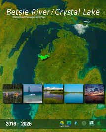
Betsie River / Crystal Lake Management Plan
Crystal Lake and Watershed Association
Conservation Resource Alliance - Betsie River
River Restoration in Northern Michigan - Betsie River
Crowd Hydrology - Citizen Science on the Betsie
Betsie River DNR Fishery Report
Betsie Lake DNR Fishery Report
Crystal Lake DNR Fishery Report
Citizen Scientist measure river height on the Betsie River. In 2013 five stream gauges were placed at varies places on the Betsie River as part of the project called Crowd Hydrology. "CrowdHydrology is an experiment currently being run by Dr. Chris Lowry at the University at Buffalo Department of Geology and Dr. Mike Fienen at the U.S. Geological Survey. Our goal is to develop innovative methods to collect spatially distributed hydrologic data." If you see these gauges on the Betsie please follow the directions on the sign and become the next Benzie County citizen scientist.
Betsie River Watershed Links
Betsie River / Crystal Lake Management Plan
Crystal Lake and Watershed Association
Conservation Resource Alliance - Betsie River
River Restoration in Northern Michigan - Betsie River
Crowd Hydrology - Citizen Science on the Betsie
Betsie River DNR Fishery Report
Betsie Lake DNR Fishery Report
Crystal Lake DNR Fishery Report